Travelogue by Rick and Kathy Howe - 2008
John, please feel free to
use, alter, delete as
appropriate. We hope this information is
useful/interesting/helpful to others. We
are, obviously, having a wonderful time.
I am currently working on this material as we sit on a ridge
overlooking
Lake Arenal in Costa Rica. We
are watching rain clouds roll across the
valley in our direction. It is beautiful
and not too ghastly hot. If no one shows
up and kicks us out, we will spend the night (and the directions and
coordinates will show up in a future message!).
I am also sending along
some additional listings for
places to stay and shop. Feel free to
use as appropriate. Many aren’t covered
in the text. They are at the bottom of
this lonnnnng missive.
John:
(1) in Guatemala your notation
of the spot near the El Florido crossing is still there and still looks
just
fine.
(2) your listing for the
Tracasa truck stop near Comayagua, Honduras looked
pretty bad as an o/n. it was filled with
stored trucks and had a big for sale sign in front.
We passed.
I am picking up this
message where the last one left
off.
We are in Coban,
Guatemala and have
decided to change our plans and make an abrupt right turn, instead of
continuing to explore Guatemala. It’s
the old getting-the-mail-forwarded
dilemma. As we have figured we need
about 3 weeks lead-time, and we need the mail to include some
medications, it’s
complicated. The spot we were hoping to
use, a brewery we wanted to visit in Honduras, wasn’t
answering their phone or returning our e-mailed questions.
So that was out. What to do?
We finally decided on, and made excellent contact with, a finca
in
eastern Guatemala that would
be happy to receive and hold our mail.
But we weren’t expecting to continue to be in Guatemala for that
much longer. So…..hey, let’s go to El Salvador while we wait for
our mail! It’s small, it will take about
the right amount of time, and we want to go there anyway.
So we headed off toward El Salvador (or El Sal-ba-DOR
as they say). We left Coban and got
about 50 miles. And stopped for a
hopeful search for Quetzals, the beautiful bird that is the national
symbol of Guatemala. Our
road took us through a lovely cloud forest
and quetzal sanctuary corridor. Guatemala is working
hard to develop this area as an eco-tourism destination.
The corridor stretches for many miles, and
has several stopping places, either at land owned by the government, or
by
private parties adjacent.
We stopped at two
different sanctuaries. After hiking up and
down and up and down
through the first one (where we had stayed the previous night), we were
treated
to tea/biscuits/fruit by the lady of the house.
She was absolutely charming, and thoroughly made up for our
disappointment at not seeing a quetzal.
We moved 50 yards down the hill to the federal Quetzal
Sanctuary, and
trekked through their part of the forest keeping our eyes peeled, but
we
weren’t that lucky; we did see other birds, and some lovely flowers,
however. Oh yeah, and an interesting
young lady on a Saturday outing who walked the whole trail in high
heels that
matched her metallic burgundy two-piece strapless outfit with very
tight pants
- we were in hiking boots. (Rick said,
“she was wearing heels???) We spent the
night at the sanctuary, in their parking lot.
We were all alone except for the security guys, who were very
interested
in our rig and what we were up to. We
spent a lot of time talking with them, and made some new friends,
particularly
a man named Esias, who even let me take his picture.
(You can see him at www.flickr.com/photos/kathyrickpics
.) It’s these real-people connections
that we treasure.
Tell me:
what’s the
difference between a cloud forest, a rain forest, and a jungle? We are clueless. And
wet.
We’ve decided that these areas have their own weather rules. But…..you only get wet once.
And yes, jungles do have bigger bugs and,
well, I guess cloud forests are more… foresty.
Despite the lack of
quetzals we had a good time at the
sanctuary. Early the next morning we
waved goodby to Esias and his buddies and made for the border. For the first time in quite awhile we were on
good road, and Rick found himself doing all of 45 mph; he got quite
excited.
Down, down through the
cloud forest; we dropped out of the
highlands and found ourselves in an area that looked like the Baja:
dry, dark
brown, with few trees. We were between
mountain ranges, and down to 650 feet; pretty darn dull we decided. Later in the day we climbed up again, over
3800 feet, ending at about 2000 feet in Esquipulas,
with a very famous (but boring) basilica.
The town was an absolute madhouse, as it was Sunday and the
faithful
were lined up for blocks going into the basilica to see its version of
a “black
rice” (Black Christ) statue. On Monday
all had quieted down, we were able to enjoy the town for a couple of
hours,
then arrive at the El Salvador border in
good order. We crossed on February 18th.
We’ll tell you about our El Salvador experiences
later. After 8 days in that country, we
returned to Guatemala through the
same border town where we had exited, and drove back up to Coban, very
much
appreciating the increasing beauty of the country as we approached the
quetzal
sanctuary corridor/cloud forest again.
We returned to our same campground in Coban, and, amazingly we
were
shortly joined by a sturdy rig with Arizona license
plates! We spent a couple of days
sharing experiences with Don and Kim, who are amazing trekkers; they’ve
been in
many countries and had lots of information for us.
They had recently shipped into Panama from Australia, and were
on their way back to the United States for a bit.
Parting company, we
resumed our Guatemala
adventuring. While our mail began its
journey to catch up with us, we turned our faces to the north, and the
magnificent Tikal Ruins. Our journey
toward the top of Guatemala took us
back into areas of more traditional dress, at least somewhat. We’ve found that once you leave the western
highland area, you are much more likely to see people wearing clothes
just like
in southern California. The
guidebook says “European,” we say “just
like us.” But aside from clothing, the
sights were as expected: lush fields
with corn and cows at lower elevations, coffee at certain levels, even
some
papaya plantations. We crossed a large
river (the Rio la Pasion)
on a barge. Well, it was a ferry, but
sure looked like a barge to us; very reminiscent of the Northwest Territories, oh yeah, and a great
little ferry
crossing the Mississippi on a back
road near Baton Rouge, Louisiana. The
whole scene was so evocative of rural
Latin America; guys washing vans in the river, kids swimming, lots of
vendors selling
treats to those in line for the ferry, and summarizing the entire make
do
attitude you find down here, the ferry is propelled and steered by a
couple of
outboard motors. Great scene.
Further north, we entered
Flores late in the afternoon. Flores is the
jumping off place for day tripping to Tikal. It’s
a nice little town on an island in the
middle of Lago Peten Itza. We wandered
the quiet streets, enjoying the water, a nice meal, good internet, and
the
constant buzz of tuk-tuks going past. We
spent the night along the waterfront right after crossing over to the
island. Shortly before we got there, I
(Kathy) was wandering in the back while we were on the road, and said
“Oh, oh,
Rick, I think you need to stop. I think
we have a broken window.” One of the two
front windows on the overhead cab had caught a rock and was shattered. Well, many phone calls and decisions later
(thanks to good internet), we had a new window on the way to us from South Carolina, being sent to the same
place as
our mail. More excitement (and cost)
than we anticipated on the day.
But on to Tikal. The
ruins here are the most famous in Guatemala, and
rightfully so. They are magnificent, and
in a wonderful jungle setting. It was
quite rainy the afternoon we arrived. We
had been told (correctly) that if you got your tickets after 3:00 pm, they would be stamped
for the
following day, and you could enter both today and tomorrow. But it was so rainy we decided to wait until
the following morning in hopes of clearing weather.
We camped in a pretty field with lots of
trees, right by the entrance. In the
morning it was still raining, but we decided to go on in.
As we approached the ticket booth, we met a
couple of fellows who had been there for the dawn patrol (there is a
trek to
the top of Temple IV at daybreak
to see the sunrise). It had rained the
whole time, they were drenched and unhappy, and would be delighted to
sell us
their tickets at a discount. Everybody
was pleased with the transaction that followed.
We entered the park and
were enchanted. It is a lovely place. If you stayed under the canopy you didn’t get
too wet, and it wasn’t too hot. We climbed
the pyramids, took tons of pictures, heard/saw birds and monkeys, and
then,
about 10:00 the sun
came out. We were on top of Temple IV at the
time. It was cool. Temple IV goes up
high over the canopy and you get quite a view of other tall structures. A neat experience. My
camera had gotten a bit wet, but dried out
in the sunshine. Apparently Temple IV is the “biggie”;
it was a weekend and lots of locals were in the park, most of them
headed to
the top of Temple IV. Bizarrely,
when they would finish the climb
to the top, they would get on their cell phones and call all their
friends.
We had a great time at Tikal; we
recommend the experience highly. There
are several nice hotels to stay at in the park, the area to be walked
isn’t
insurmountable, and it was fun. We
camped for a second night, and then went back to Flores the
following morning (about 60 kms). We had
a solid recommendation for a place to get propane so we topped up the
tank. After accomplishing that chore, we
had another ruin in mind: Yaxja.
The Yaxja ruins are off
the road that runs (generally)
between Flores and the Belize border, to
the east. You will have heard of them if
you followed the doings on Survivor: Guatemala (we
hadn’t, but the show was filmed here). At
Yaxja we found the best setting for ruins
that we have seen yet. We were
tremendously pleased. Yaxja is a
relatively new site, with major restoration work having been completed
just in
mid 2007. It has not yet been discovered
by the big tour groups, so it is very quiet and undisturbed. Set in the jungle near a lagoon, it’s a quiet
paradise. The howler monkeys were
fascinating, we saw several different kinds of birds, and the ruins
themselves
are quite amazing. We had a lovely day’s
wander, climbed everything in sight, and spent two nights beside the
lagoon,
all to ourselves. The guides were very
helpful, and they liked the fact that we were camping with them.
We were tempted to set up
a permanent campsite at the Yaxja
Lageoon, but finally decided to press on.
And we were quite close (100 kms) to Finca Ixobel, south of Poptun, where our
packages would be arriving (soon, we
hoped); we could take hot showers, eat good food, and generally relax
and
recuperate. All this was what we’d been
told by others.
And they weren’t wrong.
Finca Ixobel
is an oasis rising out of
the jungle. It has some elevation (about
1700 feet) and is in a pine forest.
There is cool shade, a swimming hole, an excellent restaurant
(that
makes its own bread), electricity (the refrigerator is gasping in
relief after
all those days in muggy 90+ heat) etc. etc. etc.
We weren’t far from
Poptun, and we wandered in there a
couple of times. The first time Kathy
caught a ride and did some shopping.
Catching a tuk-tuk back to the finca was a real adventure by
itself. Shortly after hailing my ride, my
driver (gorgeous
and about 40), stopped for a minute, stepped into a
store front, and came back with two mango fruit bars, one for me. What a delightful fellow!
The next day, we drove the truck into town to
take care of some things. My tuk-tuk guy
saw us several times as he made his rounds through town, waving and
honking
each time we came into his view. It was
great fun.
One reason we’d taken the
truck into town was to find a
welder…seems to be kind of a recurring theme for us.
If we ever write a book, it’s going to be
titled Welders Round the World. On
this occasion, we had noticed, the same day
the rock hit the window, that our rear spare tire was suddenly wobbling
around;
the welding we had had done up in Whitehorse, Yukon last summer
had failed. Fortunately, the aluminum
boxes once again had proven their value by keeping the spare from
bouncing off
down the road somewhere we would never have found it.
So, we had the whole thing remounted and
reinforced for probably about one tenth of what it had cost in Whitehorse.
As so often happens in
these situations, our encounter with
the welder and his family provided us with a nice experience and a
great story
to share. In order to do the repair we
had to first remove the storage boxes, and to do this we needed to
empty them
out to make them lighter. Well along
with the tools and hoses and other items, there were two cans of Campbell’s Chunky
Soup and a big jar of Jiff Peanut Butter being stored back there. Well, the welder commented on this while we
were unloading, and then later on an older woman, presumably his
mother, came
out and showed great interest in a can of the soup, so Rick graciously
gave it
to her and she scurried back into the house with her new treasure. Well, the uproar of excitement that ensued
convinced him that the second can needed to follow the first; but he
made a
show of hanging on to the peanut butter, and laughs were shared all
around. Along with the welder calling to
a passer-by to come help remove the boxes, and Onises, the welder’s son
helping
to reload everything into the boxes, a needed repair job evolved into a
cultural exchange of the sort we enjoy so much.
We stayed at Finca Ixobel
about a week. Our packages arrived (the
mail, via the
postal service in thirteen days; the window, via UPS – at exorbitant
cost – in
five days) and we began preparing to head for the Honduras
border. We had one more ruin to visit in
Guatemala, at Quirigua,
then we would be on to the border, and the Copan Ruinas, right on the
other
side. (In Guatemala it’s Coban; in Honduras it’s Copan; I haven’t a clue
as to why.) Just before leaving the Finca we arranged to buy some
coffee. They are well known for their
coffee and were
happy to put together a bag for us; when she was ready to seal the
plastic, she
used the flame from a candle she had lit for just that purpose. It was an old-fashioned candlestick just like
out of Dickens.
It was a special moment.
Leaving Finca Ixobel, we
headed for Rio Dulce,
a very well known watering hole right along – guess what! – the Rio Dulce.
This large river flows out of Lake Ixobel and into
the Caribbean. It’s
a favorite spot for boaters; they pull
in for fun and supplies, or protection when the weather is unfriendly
further
out to sea. It’s a lively place, and the
cool spot to camp is at Bruno’s. Bruno’s
advertises its location as “under the bridge” and that’s pretty much
just about
right. “The Bridge” is the longest such
item in Central America. It
crosses over “The River” and lets the
traveler go further south along Guatemala’s eastern
border. Tons of truck traffic, so it’s
not a quiet place, but still a pleasant if slightly weird experience.
We liked being there.
Rio Dulce is international in flavor, so we were able to do some
interesting grocery shopping; the boating crowd tends to have
American-type
food needs, so that was great! I’d been
looking for Italian seasoning for weeks, with no success, and finally
had
arranged to have some shipped to me: but there it was on the shelf of
the first
grocery I walked into! Damn!
And Rick was able to locate a new bomba – a
pump to boost the low water pressure we so often have to deal with. We filter all of the water we put into the
fresh water tank on the coach, and often the local water pressure is
too low to
get the water through the filter; hence the need for a booster pump. We’d gotten one at a Home Depot back in Mexico, but it
wasn’t very satisfactory.
We had hot showers (there
are two – the one closest to the
river is hotter), a nice chat with the manager of Bruno’s, Steve, who is an
expatriate who’s been in Guatemala for about 15 years, and gave us lots
of good
information, even walking Rick through town to get La Bomba and
assorted
hardware. He is very active in the local
area, involved with building a school, teaching English classes, etc. Very busy, and never a dull moment.
Moving south, we were
getting into lush countryside, with
banana plantations everywhere. Along the
road we were following we encountered bits and pieces of a traveling
circus,
heading north up into the Peten. We were
reminded that Semana Santa was fast approaching. We
made a great stop to visit the ruins at Quirigua, on the edge of a
banana plantation. The ruins there are
quite special. They are famous for very
large, intricately
carved stelae. The setting is tropical
and lush, and these monoliths rise up out of the grass; they are
protected with
thatch-roofed structures, which seem to add to the scene.
We were very impressed. Stelae
carved in a similar fashion are in
evidence at Copan, right
across the border into Honduras, a much
more famous site. But we found Quirigua
pretty darn special, and the setting much more interesting than at
Copan
Ruinas, which is much drier and filled with tourists.
(More on that later.)
So Quirigua was cool.
We could have stayed the night outside the entry gate, but we
were
anxious to head for Honduras. After
a quick stop in Chiquimula
for
some shopping – there is a Paiz shopping center right on the highway -- (and one last ice cream at Pollo Comparo –
which quickly melted in the deadly heat), we were border-bound. We crossed at El Florido
(not to be confused with La Florida – what is
this?????) and found ourselves in a New Country. Again,
an easy border crossing. Rick is beginning
to think he’s magic! He admits that dread
of all the border
crossings was the main thing making him think twice about this trip of
ours,
but so far, so good. As before, we were
required to present passports, title of the coach, and Rick’s driver’s
license. Everyone was courteous and
organized. This is a wonderful
crossing. And Copan Ruinas is only a few
miles away!
As I say, we wanted to
spend the night in Copan Ruinas;
however, had we been caught by oncoming darkness, we noticed a big gas
station
under construction at KM 194 just inside
the Honduras border, which would have made an excellent overnight spot;
should
be finished soon.
Our time in Guatemala was
enjoyable and instructive. We stayed in
the country a total of about five weeks and could easily have stayed
longer. We were impressed by the beauty
of the mountains, forests, and jungles we saw.
Lake Atitlan is truly an
extraordinary area, as promised. The
high mountain roads and old villages; the large numbers of indigenous
people,
both women and men, wearing traditional dress and the variety of that
dress
from one region to another; the neat and prosperous looking fields of
fruits
and vegetables with irrigation systems and signs of constant attention
from the
workers; all these things and more have impressed us.
As mentioned earlier, the roads are built and
maintained to higher standards than in Mexico, and are
generally far cleaner as well. Indeed,
we saw numerous crews along the roads not only picking up trash, but
patching
potholes and painting the concrete drainage channels installed along
the roads
– we’ve never seen a clean up crew in Mexico. The
people we met were unfailingly friendly
and helpful and added immeasurably to our enjoyment.
And, there’s Pollo Comparo, a frequent sight
along the road anywhere near even a medium sized town.
The Colonel done in a south of the border
style; clean, modern and obviously very popular… and with hands down
the best
fast food ice cream cones anywhere! Fast
food is pretty darn big down here, with McDonald’s being the most
common after
PC, and they really do it right. They
generally have large staffs of neat and friendly workers handling large
crowds
in efficient fashion, and the food tastes… just like home.
All in all, as our first stop on our Latin
American journey, Guatemala got very
high marks: just a terrific country to travel in.
By
now, you’re wondering
about our adventures in El Salvador:
We had a nice experience
crossing into El Salvador; their borders are
very organized, with professional people who know how all is supposed
to be
done. In about half an hour we were on
our way; success! Border crossings have
a reputation, you know; everyone has wild tales to tell, from “it took
us 3
hours and was a total hassle,” or “absolutely terrible; never again” to
“just
stay cool and it’s easy.” So far we’ve
made it through just fine. Rick handles
everything himself; we’ve found that if we try and share the burden we
get into
trouble. (Does this mean that Kathy is a
buttinsky and keeps trying to “help”?
Yup!) So Kathy stays in the truck
and gets out the new map. More fun
anyway…..humph. A further note on El Salvador borders, everyone
says that crossing between Honduras and El Salvador at any crossing is
really difficult, lots and lots of stories of delay and corruption. These two countries are not good friends and
their border is in dispute in several places.
Exactly the opposite is true of El Salvador and Guatemala, and the
reputation for easy crossings between these countries was another
factor in our
decision to both enter and leave El Salvador via Guatemala
All in all we spent 8
days in El Salvador. The
country gets a bad rap from folks; kind
of a step-child to other Central American countries; and with good
reason. The scenery isn’t as spectacular;
the forests
have been destroyed to provide firewood for the greatest population
density in
Central America; the beaches aren’t much (we’ve been told; they aren’t
our bag
so we don’t often visit); the churches have all been destroyed by
earthquakes
so there’s no splendid architecture; civil war took a very heavy toll
on the
population; etc. To that we would add
that despite the fact that the country has the highest per capita
income in CA
there appear to be even more people sitting idly around than in other
areas we
have visited. And there seem to be more
really fat people than usual. And the
country has lousy maps! But…..we still
had a darn good time. The
counterbalance to all of the above is that the people are charming and
friendly, and there are several cool things to see there.
And some of their volcanoes erupt quite
regularly.
We did our best not to
miss anything important. We visited Cerro Verde National
Park, camping
up
on the volcano, just over 6,000’ elevation.
It was an interesting experience.
We started up the road through sugar cane and then coffee
plantations,
then into fog, and it just got worse and worse.
Pea soup for real. We were slowly
moving along at about 5 mph, with flashers on, when we could sense the
road
starting to widen out. We figured we’d
better stop, not knowing where we were; it was getting late. After about 20 minutes the fog started to
lift and we realized we were in the parking lot at the end of the road! It was the jumping off place for hikers up
the mountain, there was a refreshment stand, and people were coming
down the
hill after their trek. We were back in
civilization! We spent some time
chatting with folks, and then had a quiet night; the fog disappeared
totally,
it was a full moon, and we had a wonderful view down on the small towns
that
nestled at the foot of this lovely volcano.
A real treat.
The area below Cerro
Verde is known by the tourist folks as
the Ruta de las Floras
and is the prettiest
area we saw in the whole country. One
special town was Juayua,
where we had a simple lunch,
enjoyed the lovely church and plaza, bought some local coffee and had a
friendly encounter with some fellows eager to pose for a picture in
front of
some of the truly wonderful murals that decorated some of the downtown
walls. An oft-recurring theme of our CA
travels is
the desire to increase tourism with all the possibilities for income
that
entails. It seems clear to us that over
the next ten years or so, many more tourists are likely to come to
these areas,
and lots of these small towns are gearing up for it.
During our time in El Salvador we moved back and
forth between mountainous and lowland areas.
Dropping into the lowlands sometimes got a bit bizarre. At one point alongside the road were folks
holding up iguanas for sale; we were unable to tell if they were alive
or
dead. Yuck.
Another special spot we
visited was Joya de
Ceren, a genuinely interesting Mayan site that is quite
unique. This site was discovered on the
edge of a
small town as new construction was begun in 1971. It
has been extremely well preserved and is
unique in that it is the only Mayan site that shows details of daily
living. This happened because in about
640 AD the town had been suddenly buried in a deluge of ash from a
nearby volcanic
eruption, preserving the buildings to the point that pottery and
utensils and
even evidence of the food on the table have been recovered in near new
condition. Much like Pompeii, except
that in this town the populace had enough warning to clear out. Very interesting, and a charming woman guide
who did her best to explain it all to us with her limited English.
We spent one night in the
pretty little town of Suchitoto, about an hour up
into the mountains from San Salvador. This
town has made a name for itself as a
music center; they have a famous concert series that occurs in – guess
what –
February! We came into town, started
chatting up the tourist office, and found out there was going to be a
guitar
concert that evening. It was really
great. We made arrangements to spend the
night at a piscina (swimming place) outside town. Unfortunately,
it was too far to walk into
town, and the busses weren’t running in the evening.
But we talked to the manager, and he said he
was going to the concert and would be delighted to give us a ride. Well cool.
Well ….. it turned out we, in our Sunday best (which admittedly
isn’t
all that different from our Wednesday best) would be riding in the back
of his
pickup truck. We managed just fine, but
it was a first for us.
Suchitoto is a university
town, and evidently a very
cultural area. The concert was well
attended, including two local beauty queens (one complete with tiara
and sash),
and a large Canadian contingent (the performer was from Canada) including
a representative from the Canadian embassy in San Salvador.
The town is a weekend get-away spot for folks from the city. We had a good time. The
venue was the old National Theater, with
peeling walls and hanging draperies to frame the stage area, and a dirt
floor. At the start of the concert a bat
started flying around. There were
speeches (long ones), three patriotic songs, and every other person
taking
pictures with their cell phones.
Surreal, but nice. (Anyone recognize that quote from one of our
favorite
films? Notting Hill.)
Oh yeah, the active
volcanoes? We never saw one get very busy,
but the El
Salvadorans are very cleverly harnessing what’s inside – geothermal
energy –
and using it, wanting to rid themselves of dependence on foreign oil. Smart.
We did go through one area with large pipe lines, a plant of
some sort,
and steam rising from the mountain side.
We traveled to the far
northeastern corner of the country to
see what had been promised as a special experience.
To get there we took some mountainous back
roads that are partly paved, and really enjoyed it.
We were at a high enough elevation to be
going through pine forests (wherever all the trees had not been cut
down). Cool and breezy.
We were headed for an area of El Salvador that had been the
scene of some of the worst and heaviest fighting of the civil war that
ended in
1992. In Perquin,
the guerrilla headquarters, the town has created and maintains the
Museum of
the Revolution (and we spent the night in their parking lot). This was a very rewarding, sobering experience. In a nearby town, El Mozote,
down several miles of dirt road, has been erected a simple wall
memorial
listing all the people in that village who were murdered in a single
massacre
by government troops (who had been trained by US advisers); over 900 of
them,
mostly children, many only a few days old.
Beside the church, which is beautifully painted in whimsical,
brightly
colored murals, a garden has been planted; it’s the site of a mass
burial of
many of the victims. This was a terrible
civil war; as you probably know, our country supported and trained the
brutal
government forces. Yet another example
of our badly flawed foreign policy during the Cold War: “Any dictator
is fine
so long as he’s not a communist”. But
enough.
We both entered and left El Salvador at its western
border with Guatemala. Traveling
west from Perquin was very
pleasant; we traveled along a series of paved/dirt rounds high in the
mountains. The people were friendly and delightful.
Chickens, turkeys and pigs alongside the roads
were healthy and happy. Oh yeah: one way
to know you are in El Salvador is because every town has a police kiosk
somewhere along the road, and it’s marked by a couple of traffic cones,
holding
a parking spot for the police car. Yes,
you just go around them.
We stopped for a last
night in the country at a lovely hotel
in La Palma, high in
the northwestern mountains. We were
surprised to find the entire hotel jammed, although they found a spot
for us to
park (and had free wi-fi!). It was the
Hotel La Palma, on the road into town but towards the southern end. It seems about 75 medical missionaries from Virginia were there,
preparing to spend a week doing outreach work in the mountains. They were great folks, medical students, and
we had good chats with them. They were
all hyper when they arrived, but exhausted when returning the next day. Such energy!
After traversing a
difficult but scenic unpaved road from La Palma west to
Metapan, we crossed back into Guatemala at the same
border crossing where we had entered El Salvador; again, an easy
time was had. We’d had a good time in
this country, and hoped that others would spend some time here. We worked our way back up through Guatemala and then
entered Honduras at Copan
Ruinas.
Honduras:
The entire time we were
in Honduras we were
concerned about and reacting to the onset of Semana Santa.
So, Semana Santa you say; what’s that? Well,
officially, it’s Holy Week. But
practically speaking, it’s more like
Labor Day weekend in the United States, only bigger; lots
bigger. All of Mexico and Central America (and, we are told, South America as well) takes the week
off. We travelers try to find someplace to
hide. Literally. We
try to locate a place to get to that’s not
popular with the holiday crowds, and hunker down until it’s all over. So our plan was to enjoy the countryside, try
to stay away from “happening” places, and endure. On
the whole, we thought we did quite well.
So… the town of Copan Ruinas is only a
few kilometers from the Guatemalan border; this was our first Honduran
destination. We arrived there on the
Wednesday before Palm Sunday, i.e., eleven days before Easter. And already the circus was in town
(different part, we guessed, from what we’d seen going up the road the
day before)
and they were celebrating the town’s fiesta week, in order to get an
early
start on the holidays. So you see what
we mean!
But this is a nice town,
and famous ruins; we stayed two
days. Upscale enough to be ready for
tourists, with coffee houses, cobblestone streets, tours to nearby
fincas, and
pizza. A very popular boondocking spot,
which we used quite successfully, is the Texaco station right beside
the
ruins. Noisy until dark, it was quiet at
night, and had electricity available.
At this Texaco station, one day we ran into a couple of fellows
from the
states (Arkansas and Mississippi, by their
accents); one has a house here and the other is a beekeeper who was
visiting
him and teaching the locals about honey production.
It was great to hear American voices. We
also shared our parking area with a German
fellow traveling alone in an old US van.
Oh, and we filled our water tanks – given the
near total absence of campgrounds down here, such basic necessities can
be few
and far between, but we’ve learned that water can be had at many gas
stations. Typically we buy fuel there as
well.
And the ruins are quite
nice. They contain the most intricately
carved
stelae in the Americas, and people
go ape over them, even though we liked Quirigua better. Frankly,
we were a little bored; and then we
went to the museum they have erected on site.
And this is one hell of a museum; built in 1998 and by far the
best
museum/visitor center of any of the ruin sites we have visited. You enter through the mouth of a serpent, and
go down a tunnel which suddenly opens into an open-air two-story museum
that
contains some of the best of the sculptures from the site.
The explanations were excellent, there is a
replica in full color of an interior temple, and many detailed carvings. It is jaw-droppingly cool.
The museum saved the entire experience for
us.
Also at the site are some
semi-tame scarlet macaws that are
happy to let you take their picture, as long as you don’t get too close. They feed them, so they hang around. We really enjoyed them, as the scarlet macaw
is very difficult to see in the wild.
There is a refuge for them in northern Guatemala, and we had
given serious consideration to taking the trip, but ultimately decided
to wait
for another opportunity. So we were
pleased to be able to see a bunch of them up close and personal. There were wild agoutis near them, happily
eating whatever the macaws let drop. So
we got pictures of them, too. An agouti
looks like a brown rabbit with no tail and smaller ears.
They are apparently becoming endangered, but
not at Copan.
As we left town we made a
brief stop at a local eco-tourist
park that had a lagoon where herons are supposed to over-winter in
great
numbers. Way down a dusty road, across a
stream, we found the lagoon; unfortunately, the herons either never had
come or
had already left. But we had a chance to
exchange greetings with locals washing their trucks in the stream, and
the
lagoon was pretty anyway.
We worked our way north
up the valley from the ruins, a lush
valley with coffee growing on the hillsides; we were really traveling
into Honduras for the
first time now. We noticed we were
seeing many more men on horseback, not merely carrying a burden but
ridding for
pleasure. Some mighty fine horseflesh. We had heard that Hondurans are proud of
their horses. And the other end of the
same day we saw a fellow trudging along with his machete in one hand
and
talking on his cell phone with the other.
(Please remember that machetes are work tools, not just weapons! He didn’t appear threatening.)
Well, no mas ruinas.
We had come to the end of our visitations to
the archeological sites preserving the remains of these interesting
ancient
civilizations. Over the years we have
visited locations from outside Mexico City all the way
into Honduras. This
is not a passion with us, but we are
very glad each time we stop; we learn and appreciate, and feel
fortunate to
have these opportunities. Copan Ruinas
marks the southern boundary of the Mayan civilization.
Early dwellers further south have not left
such distinctive monuments, although signs of them do exist. We’ll continue to keep our eyes peeled, and
of course Incan sites await in South America.
Aside from ruins, Honduras is cattle
and coffee, with bananas on the side.
Virtually the entire country is given over to these commodities. What deforestation has occurred (and it’s not
as bad as El Salvador), has
created pasture land given over to cattle, and beautiful cattle they
are. This is true throughout Central America, beautiful, fat,
healthy, almost
groomed looking cattle. Coffee grows on
the hillsides, in shade fortuitously.
And the northern coastal part of the country was developed by U.S. interests
many years ago as banana paradise. More
on that later.
In west-central Honduras we visited
several small towns with nice churches. Gracias (you’re
welcome) is a pretty little town ripe for
stardom. It has reportedly the oldest
church in the Americas, a nice
central square, and is totally torn up because they are laying new
streets. We suggest a visit in a couple
of years, after they are all finished – right now it’s a mess. We had thought to spend the night in town, at
Finca Bavaria, a
well-known spot. But we weren’t
impressed: the place looked vacant and
run-down, and when we found the proprietor, she wanted much more money
than we
had been led to expect. So we wandered
on.
Near Gracias is Celaque National
Park, in a
cloud
forest. We decided to check it out. We took our usual trek up a tiny, windy,
nasty road, heading for the visitor’s center and a quiet night’s sleep. We got most of the way up, and then chickened
out. Not being sure what we would find
at the top, and it getting late, we opted to sleep beside the road. This left us on a steep slant, which was
(just) okay for an overnight, but put the refrigerator into rebellion. You may not know this, but the type of
refrigerators normally used in RVs require being level in order to work
right. Ours said “noop,” and turned itself
off. Well, all we lost was the milk, and
my frozen
blueberries I’d picked in Alaska last summer
were all a mess, but we were concerned about further damage if we
lingered
there, so we contented ourselves with a hike up the rest of the way to
the
visitor’s center in the morning, and skipped taking a hike in the woods. And….we wouldn’t have found a level place to
camp up there anyway.
From Gracias we took a
dirt road over to La Campa,
through a pretty pine forest. Another town
with a nice square; this one
pretty dry and dusty, but It was a nice ride.
We wanted to see the town, but also afterwards we were headed
for the
town of San Juan, and then
on to La Esperanza;
our map said we could get
there from here. Hah!
Damn map; this road doesn’t go to San Juan, said the nice
man on the side of the road. We were
talking to him because we were stopped; we were stopped because the
road was
blocked by equipment trying to pull a huge truck out of a huge
ditch where it had slid on its bald tires.
That was going to take awhile, and we weren’t going to get where
we
wanted to be anyway. So back to Gracias
to pick up the “main” road to La Esperanza.
Well, let me tell you
about this road through the
mountains. It’s even paved part of the
way, to east of Belen if you’re keeping track.
Then it becomes dirt and rocks and climbing and ugly. We stopped for the night at the end of the
pavement. In Miguel
Guancapla, a dusty little town with dirt streets. We were parked kinda on the main road where
it went through town because the bridge was out. We
were surrounded by curious folks for the
entire evening.
We were the entertainment
most of the time (although at one
point a rooster across the street decided to take on a turkey he didn’t
like
the look of, and it was very exciting for awhile; it seemed to us that
the
turkey finally prevailed, ‘though both birds strutted off looking self
satisfied). We had decided to watch a
movie, and happened to choose The Motorcycle Diaries. It was great, because the kids gathered
around and watched with us, at least until the motorcycle gave out and
there
was less adventure involved. Then the
kids disappeared and the older folks stopped by to take a look. At one point we were approached by a fellow
bringing another man with him; the man was sick, and they were hoping
we had
some medicine we could give to them. We
passed along some aspirin, but were reluctant to go further than that. Afterwards we remembered that there has been
a lot of public service medical work done in these rural areas, and
they
probably thought we were visiting doctors.
We hope the aspirin helped.
Okay, up we got in the
morning and tackled this road
ahead. We knew all about it from others
who had passed this way. Well, it lived
up to its reputation; this was the worst not-under- construction road
we’d seen
yet in our travels. But we finally
reached La Esperanza, and it really was well worth all the trouble. You see, it was Sunday, and La Esperanza has a really good
produce market that day each
week. And being Sunday, all the people
in the area are in town, so it’s a good day for people-watching. And there’s a nice (lovely, in fact) church,
and…..it was Palm Sunday and morning services were just letting out. How many reasons do you need?
We had a wonderful time. Great
radishes and carrots, great
people-pictures, and even an ATM (thank you, thank you!).
Comayuaga, Honduras’ historic
early capital, was next. We were now
back on pavement, and quickly moved through Siguatepeque toward our
goal. It was that hot; when we hit town we
noticed
it was 99 degrees – in the shade. Sunday
afternoon was quiet in the old town square, a lovely spot.
We wandered around anyway, seeing several
ancient and lovely churches and other assorted old buildings. We had hoped to overnight here, but our
information required starting at the tourist office, and they had
closed at noon (on a Sunday!) and were
closed on
Monday as well, so we ultimately beat feet back to Siguatepeque,
at a higher elevation, and with a known secure spot at a Shell station
along
the highway. it was noisy, but we
managed. It was north of town, across
from a Wendys and a Domino’s. We are
finding fewer and fewer official-type places to camp and having to make
do with
what’s possible. At least we had a
security guard, water, and a place to dump tanks.
Everybody on the road was
headed up to the coast for Semana
Santa. We hadn’t been able to come up
with someplace to be for the week, and so we decided to grin and bear
it. Our plan was to follow the route we’d
decided
on, stay somewhere if it was possible, and if not then just move on. This is a bit risky, of course, but we did
make it work. We left Siguatepeque on
Monday morning, knowing in a week it would all be over with. There are two main areas where Hondurans head
on holidays, the Lago de Yojoa area, and the northern coast/Bay islands. We were headed for Lago de Yojoa.
(By the way, you just try typing that word –
it’s hard!)
The Lago de Yojoa
area is stunningly beautiful. The lake
is surrounded by lush tropical foliage.
There are many restaurants and fishing villages around the lake,
along
with coffee fincas, vineyards, and lovely homes. And
lots of eco-tourism. We stayed at the
Finca Las Glorias resort for
the night, mingling with the well-to-do Hondurans up from the city. We were down by the marina, with a great view
of the lake, under some very large trees.
It was delightful. There were
loose horses on the property, munching on the grass, and they kept
drifting
past our chairs set up under the trees.
Management would have let us stay for a few days, but we felt a
bit
Bohemian (?) in this crowd, and the crowds were getting larger, so we
spent the
morning relaxing under the trees (it was quite hot) and then moved
further on
around the lake in time for lunch… at the D&D Brewery we’d heard a
lot
about.
The Brewery is owned by
an American (they are all over Central America), and we met several
English-speaking folks during the very fine meal (and beer) we enjoyed. It was great to compare notes on traveling,
and hear from a local birder all about what we could do in the area. It all sounded great, but as you know by now,
getting up at 5:30 isn’t for
us. We aren’t even dilettantes when it
comes to birding.
But this area is so
lovely.
We started to move further north, the road ever more lush and
gorgeous. With the bright red dirt and
sugar cane, we were strongly reminded of Kauai, where we
had spent many happy times. We stopped
at the famous Pulhapanzak Falls on Rio
Lindo, really cool. The falls are 43
meters high (you figure it out) and drops down from a large swimming
hole. Actually, the site is operated as a
private
balneario with restaurant, water slide, and several play areas. People camp here, and we had been considering
it, but not during Semana Santa, no way!
There were people everywhere, enjoying picnics by the water,
playing
music, and generally having a marvelous time.
Let’s party!
We took our lives in our
hands, and headed for the north
coastal area, home of the Bay Islands (think Roatan)
and Tela - La Ceiba - Trujillo, all
popular beach towns along the Caribbean coast.
What were we thinking! Well, we
really did want to see some of the
coast, regardless of (1) the crowds, (2) we aren’t beach people, and
(3) it was
already hotter than hell and we were still up 2000 feet in elevation. The road to the coast is the main road
through the country, and it was very busy.
We had been warned that it was a dangerous road at this time of
the
year, because of all the drinking and crazy drivers, but what the hey. We took it cautiously, there were plenty of
police trying to keep things under control, and we did all right.
We headed toward Tela, with the
idea of staying the night at the Lancetilla Botanical Gardens. This turned out to be a good choice. They had already closed when we arrived, but
we talked our way in. These gardens were
begun in 1927 by United Fruit (one of the big banana outfits here) as
experimental gardens, trying to see what else they might be able to
successfully put into production. The
gardens, primarily varieties of trees actually, are extensive and
lovely. We had a very quiet night
listening to the
birds in the trees (it’s another huge birding spot) and an even
lovelier walk
in the gardens the next morning. A real
highlight of the park is an enormous stand of big fat bamboo that has
grown
across the road and forms a canopy; it’s almost dark inside, but cool
and
cozy. One of the park workers, Roger,
attached himself to me as I was walking by myself at the far end of the
park;
he walked all the way back with me, chatting about this and that. He practiced his English, and I practiced my
Spanish. I suspect that he was making
sure the “crazy gringa” didn’t get lost.
Rick, by this time, had retreated from the extreme heat and was
holding
down the fort at the coach.
We spent a short time in
Tela, right on the water, dipping
our toes in the Caribbean. It
is a lovely beach, and we had found a spot
at a nice public park that wasn’t crowded - yet. But
hot – whew! And lots of evidence of the
big holiday
festivities ahead. Off we went, on along
further east and La Ceiba. We stopped
there because we knew there was a real grocery supermarket. We are having real difficulty finding things
– decent cheese, stuff like that. So we
stocked up, noticing that we could get stuff we hadn’t seen in weeks;
but the
prices were terrible. It was a beautiful
sunny day, green and lush, and as we navigated the northern coast, we
saw lots
of small streams and larger rivers coming to the coast from the
mountains, each
one lovely and clear and rocky. There
were Cruce des Ganados (livestock crossing) signs everywhere, with all
kinds of
critters all over the roads mixing with the trucks filled with bananas
and
workers on their bicycles. This is a
nice area, if it would ever cool off!
The refrigerator is panting again; I’ve lost milk, orange juice
and
bread to the heat and humidity. Whine…
but a really pretty area.
We bought a watermelon
(our favorite fruit these days, and
available everywhere along the road) from an old man riding a cart
filled with
them that was pulled by an old horse; I got to pet the horse for free;
the
watermelon cost me about a buck and a half.
We ate off it for four days.
We turned south when we
left La Ceiba, fleeing back into the
mountains. We had toyed with the idea of
continuing along further east and visiting Trujillo. Trujillo is where
ole Chris Colombo landed, and has several interesting things going on. But we’d just had enough of all the crowds
and the heat. We decided to spend the
night in Saba and then
head for a national park above La Union that we’d heard about. Once we made the turn south toward Saba we lost all
the traffic; yes!
Saba was
interesting. By now it was Wednesday
evening of Easter Week. Saba is a
company town (Dole) that is a stop-over spot on the way to the coast. We had heard about the Hotel Executive that
would probably let us park in their lot.
We had to circle around town awhile before we found it; it’s on
the road
out of town toward Olanchito. They were,
indeed, happy to have us; there was a pool which we enjoyed, and we
were
certainly the entertainment for the other guests. We’re
getting used to this. The hotel was
interesting because it was kind
of a business traveler’s spot. We
had a
quiet night, our fans kept us within reach of cool enough, and the next
morning
we were ready to move on but needed to find an ATM.
(By now you may have figured we are using
cash for everything and relying on ATMs for funds.
This works very well except in rural areas
where you may not even be able to find a bank.)
well, hmmmmm, all the banks are closed.
Big signs, closed from Thursday to Sunday for – guess what –
Semana
Santa. These countries really take this
holiday seriously. And, there are no
ATMs in town anyway.
We knew our day involved
heading down a dirt road, into the
mountains, and there would be no sources of money in our near future. So we took a short detour.
We went partway up the road to Trujillo, having
been told there was an ATM in Tocoa, 20 kms away. And
there was – the bank was closed, but the
ATM was working. I felt very sorry for
the young couple standing in front of the bank trying to figure out
what to do;
I’m sure they had no ATM card and had counted on being able to get
money out of
their account. (And by the way, you
should have seen the lines at the banks on Monday morning, after the
holiday
was over.)
Anyway, back in Saba we headed
south, taking a dirt road that headed into the mountains toward La
Union, leaving
the lovely pavement behind. And it was a
bitch of a road (my language is getting worse as the roads do the same;
sorry). But, we had a beautiful ride;
the country is really great, with neat views at every turn. It got drier as we climbed and we lost that
lush quality to the countryside we’d been enjoying.
Hours and hours and hours later, we found
ourselves in La Union,
a scruffy little
mountain town that was thoroughly enjoying the holidays.
Looked like a town party was about to start
as we traveled through, heading toward La Muralla National Park,
up in another of Honduras’ great
cloud forests.
The road up the mountain
was another of our gems; in parts
it was really good, but where the heavy rains had done their job well
it was a
real mess. But we got all the way up to
the visitor’s center, and found a nice spot for the night.
The place was deserted, no caretaker, but a
couple from the city was staying the night, and they had gotten the key
and did
let us into the building to look around.
We had the pleasure of signing the guest book, and found the
names of
friends who had been here in 2003 and who had led us to come here
ourselves. There were many trails into
the forest, and we knew our friends had seen quetzals here, but in the
intervening years the trails have badly disintegrated, and there was no
reliable signage, and, as mentioned, no guide on site for the holidays. As far as we walked, it was beautiful; we had
rain off and on while we were there, so it was all misty and damp. I do love cloud forests! The
couple departed in the morning and we had
the entire area to ourselves most of the day.
Two or three small groups came through, leading to interesting
experiences.
The first group was a
family who owned a coffee finca 4 kms
down the road; they were checking on their plantings.
At this point we ran up against some of our
fears. This is hard to put to
paper. We know we are on the edge of our
comfort level at times here in Central America. Americans
generally (and us particularly) are
used to: (1) establishing and
maintaining their privacy and the physical space around them; (2)
voices at a
“normal” level; (3) not being stared at; and perhaps most important:
(4) being
able to establish common ground with folks, talking enough to determine
who
people are and what they are “all about.”
This group immediately challenged all four of those issues.
The group was comprised
of about 13 people ranging in age
from maybe 8-9 to a couple in their mid-40s.
They shouted back and forth across the clearing, 2 of the
teenagers were
carrying guns (serious firepower here, the ubiquitous combination of an
M-16
and a shotgun) and roamed around our coach examining it from head to
toe. They were a happy crowd, laughing and
enjoying themselves. Several of them
took off up a trail and were gone for quite awhile (we found out later
they had
been checking the property), while the rest poked around the buildings
and took
their ease, always with part of the group eyeballing us.
We were increasingly uncomfortable, and
deciding that they looked like they were going to stay all day, and
perhaps we
should take off (we had earlier decided to remain for a second night in
this
lovely spot). We had said hello when
they first arrived, but not much else passed back and forth between us.
However, it all changed
when those who went up the trail
returned. The family’s mother, very
outgoing, came to the coach, shouted “Hola, mi amiga”
and started in chatting with me. She was
very friendly, quite determined to break down the barriers, and we
quickly made
friends. This is when we found they had
their plantation (150 acres – quite large) home down the hill a ways;
and
indicating the guns, we asked about security for us in the area. No
problema
they assured us, turns out they kept an eye on things all around their
property. The end result was we felt
great again about staying where we were, and accepted their invitation
to visit
with them the next day when we came back down the mountain. It was really great!
One other thing about
guns down here: we see them every
day. Every bank, pharmacy or larger
store has uniformed armed guards with either an M-16 or shotgun;
sometimes the
shop owner himself will be carrying a sidearm in a holster, often with
extra
clips of ammunition on his belt. We
don’t really know what to make of this armed presence, as the general
population we come into contact with seems happy and easy going, not
threatening at all. We asked Steve, the
manager of Bruno’s back in Rio Dulce, about it and he said it was
largely a
carryover from times past when such security was a legitimate concern. He said that at least for some folks, if a
business doesn’t have security on site people will be reluctant to work
there thinking
they may become a target because they are unprotected.
Whatever, occasionally we experience some
discomfort, but have pretty much accepted the situation.
By the way, for comparison purposes, it is
not all that different than what you see in Mexico, but it is
more prevalent down here.
One other group that came
by was half-a-dozen teenage boys,
who simply arrived, sat shyly on a ledge and watched us quietly for
about 15
minutes, gestured they would like a little money, and left when we
refused. A bit more unsettling, but we
were still bubbly from our new coffee friends, and didn’t let it bother
us. Towards the end of the afternoon a
small family hiked by, said hello, admired the coach, “Buen Carro”,
and moved on. It rained off and on all
day, but cleared before dark; we were alone, the birds were singing, it
was
delightfully cool, and we enjoyed a quiet evening inside and settled
down for
the night.
The next day we did stop
by Finca Buenos Noches, the coffee plantation,
and spent an hour or so with Amilcor and Lilian Murillo and their
extended
family and workers. They are lovely
people, working the family finca which Amilcor inherited from his
father. They stay up on the mountain for
about 4
months out of the year, harvesting the coffee, and live the rest of the
time in
La Union, where they raise dairy cattle (they are running about 800 head, we think). They
returned to La Union about 3 years ago,
after spending the previous 10 years at Roatan, in the Bay Islands. We
think this is one reason they are so
outgoing and friendly with foreigners; Roatan is, of course, in a huge
tourist
area. The coffee they produce is sent to
Roatan for processing, and is sold at Café Buenos Noches in town
there.
We cannot overstate the
pleasure we took from getting to
know these people. They were friendly
and interested in us, happy to talk about themselves and their life,
showed us
all the apparatus and processes of a working finca, and poured us a cup
of
great coffee to boot. Before we left we
invited everyone to come see our “casa rodante”
and took lots of pictures, which we will send to them.
We also were able to take a bag of coffee
with us, keeping intact our plan to buy coffee in each country we
visited. They wanted to give us the
coffee, but we
really wanted to be able to thank them financially for all they had
done for
us. Hugs and kisses around, we continued
on down the road. By the way, they spoke
almost no English, all of this was accomplished within the limitations
of our
extremely limited Spanish abilities. We
find more and more that when we encounter someone who will speak slowly
and
limit their vocabulary and just work with us, we can communicate pretty
well
with them and it is very enjoyable all around.
It seems pretty clear that the folks who make this effort with
us always
have some background in working with Gringos somewhere.
We had been a little
concerned about being able to get off
the mountain; the road is quite steep and in bad shape in places. We had experienced quite a bit of rain while
we were there, and our friends had commented this would not be a good
road in
rainy weather, partly because there is a river to ford down near the
bottom. But no problema.
At the ford, folks were washing cars and
enjoying playing in the water; we waved, crossed, and went on.
Ahead of us lay about 3
more hours of dirt road, but lovely
vistas and a pleasant drive. We finally
reached pavement (yes!) in Limones, and then made quick work of it to
our next
“road experience.” We were heading
toward Valle de Angeles, a mountain town above Tegucigalpa (the
capital). We wanted to come in the back
way, and enjoy La Tigra
National Park, a cloud
forest that lay along this secondary route – also hopefully avoiding
the crowds
we anticipated at the main entrance area as this was Easter Weekend,
the grand
culmination of Semana Santa. And we met
our most challenging road yet. All went
well as we headed into the mountains, we even had a section of
pavement; then
we visited San Juancito, a charming old mining town (burros wandering
down the
middle of these tiny cobblestone streets), and then headed up the hill
to El
Rosario, the back entrance into La Tigra.
This was a very bad
decision – vehicle-wise. We had
read that you can camp the night at
the visitor’s center at this park entrance.
Yeah, well, sure. But you have to
get there first. This was very steep,
very tight and windy, very rocky, very narrow with tight uphill hairpin
turns
that we only just were able to make, and had lots of traffic on this,
Friday
afternoon of Semana Santa. Well, we
finally
got there. And the small parking area
was so steep there was no way we could even get sort of level. Once again we were thankful to have chosen
the Tiger (newly renamed La Tortuga – The Tortoise).
Anything bigger or with less ground clearance
would not have made it up this hill. We
do not recommend it without walking the road first.
But here we were; they
welcomed us at the visitor’s center
and showed us around. We slept uneasily
through the night (Kathy worrying about the refrigerator again; Rick
wondering
how the hell he was going to get back down the hill).
We had decided since we had made it through
this ordeal we were going to finally take a good hike into the cloud
forest. A guide wasn’t required, as these
trails were
very well marked. They showed us where
to get started, and we began. Not two
minutes later, this very nice fellow who worked there attached himself
to us
and indicated he would keep us company.
With no anticipation of payment.
Cristobal was great. He pointed
out flowers and birds, showed us the old mines (the entire mountain was
heavily
mined in the 30s – gold and silver), and patiently stopped each time we
wanted
to take pictures – even helping in our unsuccessful quest to get a
butterfly to
sit still for a photo. When we returned
we, of course, tipped him despite his protests.
We had made another amigo.
We did, of course, get
back down off the mountain, and
proceeded to Valle de
Angeles, where we spent a
charming Sunday in this lovely, tourist-friendly mountain town in a
pine
forest. We spent the night there, having
gotten permission to stay in the hospital parking lot, although the
Parqueo
Touristico would have also been a good choice at a time other than
Easter
weekend; the next day (finally Monday after Easter!) we went further
down the
hill toward Tegucigalpa, the
capital. There were road crews out along
the road, picking up the trash after the long holiday; delightful! We stopped at another mountain town, Santa
Lucia, which was very quiet after the holidays.
The children were back in school and we had a wonderful time
taking
pictures of them enjoying their recess.
They were as delighted with us as we were with them. It was a great exchange.
Tegucigalpa is still in
the mountains, and in a very nice setting. We
hadn’t planned to stop, and easily made our
way around the city; suddenly we found ourselves on the road to the Nicaragua border at
Las Manos, a couple of hours away. We
weren’t planning to cross the border today, but found nothing to hold
us
back. Suddenly, the border approached,
Rick grabbed his paperwork, and about 45 minutes later we were in Nicaragua. How
about that! Damn, he’s getting good at
this (but we know
worse borders are ahead). Nicaragua deals in
cordobas, incidentally; about 15 of them to the dollar.
New money to convert each time you buy a
watermelon. Cool. Incidentally,
we have decided that, as a
general rule, it is a good idea to arrive at any border with the
equivalent of
about $75.00, either in dollars or in local funds.
There won’t be an ATM at the border; some of
this money will go to clear the “old” border, some to get through the
“new”
border, and any left over to get you to a source of new funds.
We loved Honduras. We
spent 12 days there in all, and enjoyed
everything about it (except perhaps the roads that needed help). The people were unfailingly helpful along the
road, and friendly when given the chance.
On the roads, we continue to find that paved roads down here
tend to be
pretty darn good, better than many of the roads in Mexico. But
there are fewer of them so the wandering
traveler who wants to experience rural areas spends a higher proportion
of time
on unpaved roads, which tend to be quite bad.
Unlike northern Canada, the dirt
roads down here do not seem to receive any regular maintenance. They just are what they are, which is uneven,
rocky, and rutted. As to the people,
well they are just wonderful. We find
ourselves experiencing more and more delightful encounters with these
friendly,
happy folks. They take life as it comes,
working hard and enjoying a life without all of the pressures and
distractions
we are all so used to, and just seem so pleased to have a chance to
meet
us. It is proving a wonderful
experience.
We are in Nicaragua now, at the
Club Campestre outside the town of Esteli, continuing
our trek towards the Panama
Canal. We
wish we had started sooner in the winter;
we have a sense of time passing too quickly.
We know that Costa Rica and Panama have
definite rainy seasons that will begin about the time we get there
(rats) and
that it’s not going to get any cooler.
But hey, it’s all too much fun to stop!
Also, based on sound
advice from other travelers, we have
made copies of our drivers licenses and have had them laminated. When asked to present same, we have only
handed over the copy, never the original.
This has worked well, and helped us survive an unpleasant
experience in Nicaragua. We
were stopped alongside the road by an
“official” who demanded Rick’s license.
He gave him the copy; the officer demanded the original, which
Rick
would only show him through the window.
The officer then demanded a bribe of $20 to give back the copy;
we
simply drove away. If the officer had
had the original in his possession, it would have been more difficult.
Best Wishes and Happy
Travels, Rick, Kathy and Trav’ler (aka
La Tortuga)
*********************************************************************************************************************
Next
Installment May 2008
* * * * * * * * * * * * * * *
Carreterras
Sinuosas, Puentes Angostas, y Pavimento en Mal Estata. All that means windy
roads, narrow bridges, and pavement in bad condition – aka welcome to
Central America!
We
left you as we had just crossed the border into Nicaragua.
We are always excited as we enter a new country.
We have great expectations of the sights to be seen, the people
to be met, the fun times to be had. Nicaragua
would be a really new experience for us: the
poorest country in Central America; the one most recently torn apart by
war; the one with the most volcanoes; a country that had suffered a
devastating earthquake in 2000 and was still recovering; we were
intrigued and inquisitive.
In
the final analysis, we were a bit disappointed. And
we found we were not alone when we met others traveling in the area. Despite reports from some friends who had had
a fabulous time, general consensus agreed with ours.
Our judgment is colored by certain events: an
incident of vandalism; a cop demanding a bribe; a hot, dry and
unappealing countryside; the lack of general friendliness on the road. We did have good experiences, and at least one
act of major kindness where not expected. And
we are well aware that we skipped some interesting areas that others
had thoroughly enjoyed. But ultimately we
found ourselves pushing on and hoping that Costa Rica would prove more
enjoyable. But you want to know how it all
went…..
Heading
toward the Nicaraguan border we noticed that the
countryside was becoming very dry and brown. Cattle
country, with few trees and little water. We
crossed into Nicaragua from Honduras at the small town of Las Manos. Again, as with other crossings, it proved to
be a good choice. Nicaragua and Honduras
are friendly to each other and make it easy for the traveler. We were done in 45 minutes and on our way. We had found ourselves at the border about
mid-afternoon, unusual for us, and started looking for a place to hang
for the night. We headed for Ocotal, a
border town, but found it to be far too quintessentially
border-town-ish to be anything other than pretty ugly and rough. We did find a grocery store and a bank (gotta,
in any new country), but moved on.
A
ways into country, we reached a river and then green tobacco fields;
things were looking up. We’d heard about
the Club Campestre, a private club about 4 miles
north of the town of Esteli that would let us camp; we
spotted it and swung in to check it out. What
a cool spot! They were happy to have us,
and only asked that we give the vigilante a couple of
bucks a night to keep an eye on us. Antonio
took very good care of us, made sure we could find electricity, water,
dump station, and where the dressing rooms were to change before using
the pool! We found a nice grassy spot with
some shade, and settled in. We were
surrounded by lush, green tobacco fields; very bucolic.
Esteli
has the reputation of being a good spot for language schools, and of
being a nice town as well. It seemed to
offer possibilities for a nice wander. We
found a great produce market and bought some really yummy veggies (an
oxymoron to Rick, of course); however, while we were having lunch the
coach was vandalized. Not a huge deal, but
someone had taken off with two of our tire pressure sensors (useless to
him and $50/apiece to us – not including shipping costs) and let the
air out of a third tire (couldn’t get the sensor off, we guessed, and
got piqued). This made us pretty darn
unhappy. Then I watched the guard outside
one of the banks actually frisking folks before he would let them in
(took a pair of scissors off a guy while I stood there).
And there was graffiti all over the walls. (Esteli has a
reputation of being very political; there are marvelous murals on the
walls commemorating the struggles they had during the war.
That was fine; but the graffiti was very new and very angry
looking.) Well, after all this….we had
been considering staying a week or so and taking some more Spanish
lessons. But we just didn’t feel
comfortable and decided to move on.
On
the other hand, that same day in Esteli a delightful fellow spent most
of an hour showing Rick various places in town that might have a
rear-view mirror for us. We’d seen mirrors
mounted above the rear window of many vans to allow the driver to see
immediately behind the rear bumper and thought that would be a cool
addition to La Tortuga. After asking at a couple of places without much
success, one older fellow took us under his wing and rode with us from
shop to shop until the right thing was located. He
spoke good English, and some German as well, and was trying to get a
job in the tourist industry. We told him
to keep trying, as he would be a great asset to all of us tourists and
travelers. So, as always, a really
positive experience with someone served to help balance out the
occasional hard times.
Esteli
is in a large agricultural valley; leaving, we climbed over some hills
and turned north, heading up into a mountainous area and the retreat
known as Selva Negra. We passed many coffee fincas as
we climbed. It was quite lovely, and we
were on a beautiful new road. Then we hit
Matagalpa and the road died. Enormous
potholes, big enough to give an elephant trouble. We
knew the locals were pretty unhappy as they had erected signs with
pictures of cars and people falling into the huge holes.
They were kinda cute, actually. We
were glad we were only taking the road one time, not every day. On we went, with Selva Negra in view. Selva Negra is Spanish for black forest – like
in Germany -- and is a large coffee plantation and eco-tourism
destination with a world-wide reputation for sustainability. It was founded by Germans who were brought
over by the Nicaraguan government in the 1880s to show them how to grow
coffee, and they have thrived here. We had
been told their parking lot was available to us, and that the
restaurant served very good German food. We
wanted to check it all out.
Selva
Negra, about 10 miles north of Matagalpa, is a lovely place; they have
a chapel and reception area, both of which were being prepared for a
wedding about to happen. There are flowers
everywhere, a large pond with a group of noisy geese, birds galore,
hiking trails into the forest; all very Bavarian and charming, and a
very cool and lovely 5200 feet in elevation. This
is a fascinating place and a highlight of anyone’s trip to Nicaragua. Well worth seeking out.
The
next morning we continued on up this lumpy bumpy road, intending to
visit the town of Jinotega and then take a dirt road through the
mountains, ending up back at Esteli. As we
climbed, we passed flower and produce stands selling the local output. The vegetables were humungous and the flowers
just as spectacular. It was quite a scene,
misty (still in cloud forest at this point). The
scenery, too, was beautiful, but the road got worse and worse. We passed out of the forest and back into the
dry-brown hills with which we were so familiar; we became less and less
interested, and finally decided to retrace our steps back down the
mountains rather than continuing on. That
was okay with us, as we were headed for Leon (the old capital) and its
pleasures. We had heard that Leon is a
very interesting city, and were anxious to see it.
Well,
dammit, Leon was going to have to survive without us.
I guess it’s cumulative; REALLY bad roads – that are going to be
that way for a REALLY long ways -- may just be beyond us right now. Darn it, we wanted to see Leon, but this road
was the pits – BIG PITS. So, after a few
miles, in sweltering heat because we were now back in the lowlands, and
knowing Leon would also be very hot, we turned around.
Another time, after the government starts working on these
roads, we’ll come back. We know we are
shooting ourselves in the foot, because we skip some places we would
like to see. But we remind ourselves that
we are travelers, not tourists; we see what we see, not trying to cross
everything off our lists.
Back
on the main highway (the Pan-American, to be exact), a good and decent
road, we made our way southeast towards Masaya National
Park and its nifty, active volcano. The
dry brown countryside looked a whole lot like Bakersfield.
Until now we hadn’t spent much time on the Pan-Am because we
wander on the back roads so much. We were
encountering more traffic and – got stopped by a policeman. It was a congested area; we weren’t unduly
startled, as police will often pull us over and check our papers. We knew along the Pan-Am we were more likely
to be faced with police irregularities. It
had been suggested to us that having copies made (and laminated) of our
driver’s licenses might keep us from having to pay a bribe at some
point. So Rick tried it out.
He handed the fellow his duplicate. The
man demanded to see the original. Rick
showed it to him through the window but wouldn’t give it up. The guy got really irritated and demanded $20
to give Rick back his duplicate. Rick
smiled and we just drove off. We felt smug. What a jerk! There
are several reasons why we tend to spend our time back in rural, out of
the way places and this is one of them. The
only times we’ve felt uncomfortable in any way down here have been when
we’ve been on or near one of the major highways. The
traffic, of course, is much worse, the police stops are much more
frequent, and the border crossings are much more difficult. It’s the back roads for us, just as it is up
north.
Volcanoes
are cool. Vulcan Masaya is really cool. We arrived just as the park was closing, but
were allowed to stay in the parqeo overnight and then
drive to the top the next morning. Masaya
is a collapsed volcano with an open area up at the top – misty sulphur
steam coming up to meet you, strange swift-like birds, no foliage -- but huge, huge bumblebees; how weird is
that! There are supposed to be parrots
living there that have adapted to the fumes, but we didn’t see any. Coming back down from the volcano I saw
plumeria trees in bloom. I was nonplussed,
as I was used to seeing this flower in Hawaii, and then realized that
the climate and terrain weren’t all that different, really. A revelation. The
visitor center here is a really good one; just enough information to be
helpful without so much that you are overwhelmed. Some
of it was in English.
After
wandering the volcano and environs, we went on into the town of Masaya;
a hub, it was rather chaotic and we were our usual constantly lost
selves trying to find our way to the town center. But
we did. This town has two market areas,
and we visited both of them. We started at
the “nice” artesania one, which had some very nice
things; some were from Nicaragua and others from further away. They had coffee for sale, but I thought it a
little pricy and hoped to find a better deal elsewhere.
Didn’t, of course. And Rick was
looking for sandals to replace his worn ones; this is a leather goods
area so we had high hopes.
Not
finding the right shoes at the first market, we decided to take a taxi
to the more local market across town. We
had first tried to drive there, but got lost in the maze of streets and
then came to a spot where we couldn’t get there from here, so went back
to where we had parked before. What an
eye-opener we found when we arrived at the “everyday” market. It was enormous, full of little walkways
between stalls and tons of fun. And even
though it was a Sunday, Rick found someone to temporarily repair his
sandals while he continued his search
We
have seen, over and over, here in Nicaragua that the people are very
poor. Goods are quite inexpensive; if you
wanted to retire here and build a home, we suspect it would be pretty
cheap. We did see some begging, although
no obnoxious or pushy behavior. But there
are fewer work trucks; horses are everywhere, hauling carts filled with
goods, being ridden, and being used for “taxis,” pulling people around
town in their carts. Mostly they look
pretty tired and underfed. We also saw
tons of people on bicycles, often two per vehicle.
We were told that the owner of the bike was often the one
sitting and being pedaled by the passenger.
Granada is quite close to
Masaya, and it was our next stop. Granada
is on the shores of Lake Nicaragua, and it is quite the thing for
travelers like ourselves to spend their nights at the tourist park
along the lake. We pulled in, found a
spot, and soon were joined – by a Rumanian-French couple traveling with
their 3 small children. Don and Marilena
were delightful; their children a joy to meet. The
family was on a two-year trip in the Americas, having seen the States
and Canada and now moving further south. We
had a nice evening’s chat, compared notes on shipping plans for South
America (they were starting to get organized and so were we), and
parted company the next day. We were
headed into town, and they were planning a morning of school lessons,
internet, and exploring along the lake. We
keep hoping to run into them again, but so far they haven’t
materialized.
Granada
is often compared to Antigua, Guatemala. It
is an old colonial city with a big town square and nice buildings. We wandered around, finally found the tourist
office squirreled away in a corner, and checked out some of the sights. We tried hard to like it, and indeed found it
open and friendly and clean. But we’ve
been to so many beautiful cities, including Antigua, and found Granada
kind of ho-hum.
We
were finding that in Nicaragua it was simply a poor economy. The market goods were basic, we saw less
sophistication among the people, and they generally seemed more
discontented and less happy than in the other countries we’ve visited.
So
were we. Each place we tried seemed less
than what we had expected, and we kept moving on. Suddenly
we were in the southern part of the country and getting close to the
border. I called out “Slow down” and
grabbed my camera. I wanted a picture at
the place where the TransPacific Canal would have crossed through this
area had it been built in Nicaragua instead of Panama.
I’d figured out pretty closely where it should be and snapped
off a couple of shots. Not a very
spectacular spot, but at least I recorded it for posterity….
As
we approached the Costa Rica border crossing, the
countryside became a little greener, with more trees; we were near
water; this, to us, was the prettiest part of Nicaragua.
We hit the border and chaos ensued. Our
luck had run out.
All
in all, Rick says this border crossing wasn’t more difficult than any
of the others; the process is the same each time. But
it was filled with people insisting on helping and having their hands
out for money and saying they could do this and he should go here and
this is the guy and we can help make this go faster and the officials
didn’t want to talk to him but were looking for “his guy” and we think
they were all in cahoots and it was too expensive and we think we got
rooked and all the other things we’d heard of from everyone we talked
to. And it’s horribly hot and dusty and a
real mess.
This
is the only national border where everyone has to use
the same crossing, right along the Pan American Highway.
We did notice a footpath on the map that led between northern
Costa Rica and Lake Nicaragua, but we sure wouldn’t have wanted to try
that! Every other border crossing we have
done (including into Panama, stay tuned) has been in a rural,
relatively quiet area with few people and no confusion.
This was Grand Central Station. But
we finally made it through and limped on down the road into Costa Rica,
licking our wounds. After an hour or so,
we realized it really didn’t matter all that much; it’s all just fine,
regardless of momentary frustrations.
And
then we hit the first large-ish town in the new country – Liberia
– and immediately realized Costa Rica was going to be different. Rick thought he’d died and gone to heaven. Not only did they have a Burger King, but a
very nice supermarket with some of the things we’d been missing for
eons (sweet Italian sausages! I could make
lasagna!). Not for these reasons alone,
but for its charm and cheerful air, we liked Liberia very much. We spent a couple of days in the area, coming
in for shopping and internet access. While
walking around town we realized all the traffic was stopped on one
street. We thought it was a parade, but no
– a peaceful protest march in support of more rights for university
teachers. We cheered them on.
We
were hanging around this part of the country waiting for friends whom
we had first met in Oaxaca, Mexico. They
had moved through Central America more quickly than we, and were on
their return trip back toward the States after going all the way to
Panama City and spending considerable time there. We
waited for them at the Delfin Trailer Park about 4
miles north of town, which worked out really well.
This was a very nice place, friendly, with electricity, a nice
swimming pool, showers, and plenty of shade. Oh
yes, and horses nearby munching away. After
our friends arrived we all went camping and hiking for a couple of days
in the nearby Rincon de la Vieja National Park. There was a semi-tame coatimundi wandering the
parking area where we camped, along with monkeys and birds as we hiked
along. This area is thermal, with mud pots
and hot springs and waterfalls. During the
day we were inundated with rental SUV’s all lined up in a row, but at
night it was just us and the starry skies.
We
were interested in traveling around the side of this volcano, up into
the northern lowlands, and then around the other side where we would
drop down and pick up the road to La Fortuna, our next point of
interest. It got greener as we went along
on a nice paved road, closer and closer to the volcano (Vulcan
Miravalles this time). This is an area
where the government is developing hydroelectricity; there are regular
wisps of mist coming out of the ground. There
are many tourist facilities in the area because there are hornillas
(literally little ovens) and tumeroles (mud baths); we
got permission to overnight in the parking area of one of these
facilities, and, for the first time, realized how much more
tourist-oriented Costa Rica is. They want
and expect money for everything. Ten
dollars just to park on a very unlevel, grassy area for the night. But it was quiet, and again we had horses for
company.
The
next day we went on up between the two
volcanoes (Rincon de la Vieja and Miravalles), driving through very
nice countryside and stopping to check out a new flowering tree on the
one hand, and to take pictures of some incredibly cool goats on the
other. This stop caused a couple of
friendly fellows to come chat with us and talk about the plantings we
were seeing. They said that in another
month (this was early April) the rains would come and the area would be
green again. We thought it looked pretty
nice right now! There were fat dairy
cattle in the fields; we decided this was a pretty darn nice area.
On
above Vulcan Miravalles (now an unpaved road), into the lowlands
(pineapples, sugar cane and row crops) and (now paved) through the
cowboy town of Upala (rodeo tonight) and back into the mountains again,
to Guateso, also known as Guatuso, or maybe Guatuzo, and which is
officially San Rafael de Guateso (welcome to maps of Central America)
and then to La Fortuna. This
is a major tourist area. La Fortuna sits
on the slopes of the east side of Vulcan Arenal, a very active volcano. The scene reminded us of Denali NP in Alaska. People come here from all over to see the
volcano spit fire and spew smoke – if they can get a clear view. Like all really tall mountains, it makes its
own weather, and is often too cloudy to be tourist-friendly. Got lucky: found
a camping spot on a river that had a good view window, it was a clear
night, and the volcano performed admirably. You
could see the fire bouncing off the slopes and then look away and see
all these beautiful stars. A truly cool
deal. You reach this spot by heading south
off the main road just at the guard shack near the dam, then going on
beyond the entrance to the national park, across the bridge and making
a quick left, fording the stream.
Lake
Arenal and Monteverde, two major-major destinations, are near here. Lake Arenal was formed by the
creation of a hydroelectric dam, and is quite lovely.
The drive around the lake is just great, and the road has been
recently paved so it was a pleasure. The
road winds around, crossing many streams. It
was here that we first met the phrase (to be seen everywhere in Costa
Rica): Puente Angosta,
which means narrow bridge. It seems that
regardless of how wide the road is, they never seem to widen the creek
crossings. The road goes down to nothing,
there is a yield sign in one direction, and everyone crosses their
fingers no one comes at them quickly in the opposite direction. We found these little bridges in small towns,
big cities, along very busy corridors of the Pan-American highway –
everywhere. Now how can you justify that? But I digress.
There
are a couple of cute towns to browse along the way around Lake Arenal,
and we were delighted to find a spot on a ridge overlooking the valley
where we could spend the night next to some beautiful and friendly
cows/calves. It was cool and breezy; late
in the afternoon we watched a storm coming across, moving overhead, and
moving on. We were in an abandoned, or at
least not currently active, upscale housing development, and were very
glad it was ungated and available to us.
We
wanted to continue on around the lake and head for Monteverde,
supposedly a really nice area settled by Quakers and home to the
country’s most famous cheese. However, we
knew the road to get there was unpaved and gawd-awful.
we took a quick break and headed back down the mountains to the
hot/dry town of Canas (or Canos or Las Canas or Los
Canos – you decide) to see the Las Pumas Rescue Center.
This is a private foundation that is devoted to rescuing or
housing wild animals that need shelter. We
saw pumas and magueys and other cats, and plenty of birds and monkeys. A nice spot.
Then
back into the mountains, through Tilaran, where the pavement ended, and
then up this really, really bad road to Monteverde by
way of Santa Elena. We wandered the area
and visited Monteverde with its famous cheese factory, and spent the
night in the parking lot of the Argentine Café, home of an
incredible chocolate soufflé, and an unfortunately un-level
parking lot (refrigerator rebelled, of course). Then,
the next day we took the only other way down out of the mountains away
from Monteverde, and it wasn’t any better (which we already knew). Each way, to get to pavement was about thirty
miles of incredibly difficult road. But
you survive. Worth it (?) maybe, but only
because of the soufflé. This is one
of many really touristy areas in Costa Rica; folks fly in from
everywhere to do canopy tours and butterfly houses.
But they all come up the roads in rental cars or shuttle vans so
who cares. Anyway, far too many
billboards, inns, resorts and spas for your intrepid correspondents. On another trip, we’d give this place a pass.
After
all this we wanted to crash for a few days. We
headed to a “real” campground outside San Jose, the
country’s capital. This, the Belen
Trailer Park, is an oasis of comfort; we spent a week.
There is w-ifi, electricity, water, a laundry, and showers. High enough in the mountains to be cool and
comfortable. We took two trips, the first
to get propane for the vehicle, and the second to see some of the
surrounding towns.
This
should have been a lovely day, and we did manage all right. But the roads were, again, really awful; and
the Costa Rican drivers were the worst we had seen yet.
The traffic was heavy and we would get stopped on these curvy
mountain roads; drivers would simply go off into the dirt on the left
side of the road, forcing oncoming traffic to go around them; they’d
pass each other, honking and pushing, regardless of what was happening
ahead. It was all rather nerve-wracking. We finally gave up and started to head for the
barn, and then it began raining like the devil. We
got into the San Jose suburb of Alejuala, hoping for a shortcut to
home, and ran into a huge parade! It seems
the big hero of the Costa Rican revolution was born in this town and
this was his birthday. Horses everywhere,
crowds galore, traffic backed up for forever; what a gas! Hard to
maneuver through, of course. We did get
back eventually and looking back on it we had had a pretty good
adventure.
After
we returned, we found out that we were in the middle of a 3-day
weekend, which had added to the traffic in these pretty little resort
towns; we decided the better part of valor would be
to hunker down and wait it out. And we
spent some of this waiting period trying to decide why we weren’t
enjoying Costa Rica as much as we had expected. What
was wrong?
I
think I can explain. Let’s talk about
Costa Rica for a minute. It has about a
billion volcanoes; they are strung across the country from west to
east, continuing a chain from Nicaragua, and are major destinations for
visitors, along with two lovely and popular coastlines.
It is an incredible country for outdoor enthusiasts; you can
hike, snorkel/dive, go birding, raft, canopy/zip line tour, etc. etc. The whole area is developing rapidly, with
condominiums and planned developments in all the popular areas – ERA,
ReMax and Century 21 are all active here. It
is more modern than any of the other CA countries we had been in to
date, although it has really lousy roads and the worst drivers we’ve
come across, often just plain discourteous. It
is the most expensive country in CA. They
have their own money but are just as happy taking dollars off you as
colones (at 500 to the dollar, the money exchange was an ongoing
challenge. Don’t care what you call it, 60,000 of anything seems like a
heck of a price for a tank of gas). We
either knew all these things or found them out quickly.
What we found, as a result, was that we were having trouble
settling in and enjoying ourselves.
Each
country has its own charms, but sometimes it’s hard find what appeals
to you. We had wandered from one area to
another, not finding “our” Costa Rica. We
are strongly put off by excessive tourism. We
like quiet, out-of-the-way areas with mostly locals.
We basically don’t do beach areas with their heat and bugs. We like to meet local folks and find a
commonality. Everywhere we went it seemed
we were being charged for things that would be free in most countries. We were coming to the conclusion that Costa
Rica used to be a country but was now mostly a tourist destination. We didn’t give up, but were getting
discouraged.
We
also knew that most people who visit Costa Rica arrive by plane and
either rent a car or take tour busses to see the sites.
They either aren’t dealing with the roads and drivers at all, or
are in a car that isn’t theirs and to which they have no sense of
responsibility (to say nothing of the pots and pans that aren’t
crashing down around their ears!).
Well,
what to do? We couldn’t just stay in our
campground, and we really did want to keep trying.
So we struck out again, and this time we struck gold. To the east of San Jose is the Orosi-Cachi
Valley area. We decided to go check it
out. And we fell in love.
The area reminded us of a smaller version of California’s Napa
Valley, 50-60 years ago. It’s lovely and
green, nestled in the hills; instead of vineyards there were coffee
fincas. In this area, the bushes were all
in bloom, covered in lovely white blossoms; the plantations were neat
and well tended; streams ran through the valley, with puny high and
narrow bridges keeping most people from crossing. The
town of Orosi has a Franciscan church that looks like it belongs in
rural California; one-story whitewashed adobe, red tile roofs, and a
neat little rose garden along the side. We
weren’t homesick, but definitely nostalgic. We
spent the night parked in front of the church and alongside the soccer
field.
This
town has an incredible Italian restaurant, the Stella du Nord, which
lived up to its reputation of making wonderful pizza.
The view from its location high above the valley was just as
impressive. We strongly felt a sense of
community among the residents here; women were walking their children
to school and then gathering for some activity of their own, everyone
was open and friendly, the kids were all dressed in little blue
uniforms.
At
another town in the valley we stopped at a ruin to take some pictures,
and were impressed at how clean the area was and how well the ruin (of
a very old church) had been preserved. There
wasn’t much left, and it hadn’t been reconstructed, but you had a sense
of reverence for what had been there. The
setting, and the color of the building, made us think of the Alamo –
but not surrounded by the huge city of San Antonio: just a quiet
country location. It was quite special.
San
Jose had been at about 3,000 feet and nice and cool.
Orosi was about 5,000 feet and even cooler.
When we reluctantly left and continued east, our goal was to
stay in the mountains as much as possible as we headed towards Panama. So we mostly followed the spine of the
Continental Divide.
This
led us up, up, up to over 11,000 feet (and a temperature of 53 degrees)
as we went through the Cerro de Muerte area. We
had been given some info about a place to camp right at the summit but
somehow missed it and plunged on down the other side.
And what a plunge it was: we
dropped nearly 9,000 feet in 29 miles. We
took a short detour into the highly recommended tiny Rio Sevegre Valley. It was steep and tight and narrow, even one
lane part of the way, but incredibly beautiful, following the river
down and down. This is a weekend retreat
area and there were lodges/spas, and retreats around every corner. What a lovely place for a getaway. It was quite enchanting. But
too early in the day to stop, and no good places for us anyway. So we climbed back out and headed on.
I
was determined that we weren’t going to leave Costa Rica without
checking out the beaches, even if briefly. I’d
heard too many wonderful things. So we
turned Pacific-ward, taking a steep road down out of the mountains and
over to the coast. We stopped for the
night right along the water, at a small national park beach called Playa Pinuela, east of Domnical. It was lovely, though very hot; I
walked the beach (picking up sand fleas that tormented us for the next
several days, but SO WHAT), the sunset was stunning as a backdrop for
the palm trees, all you could hope for. We
had a quiet night, then in the morning, before moving on, watched
fishermen bring in their catch and load it into refrigerator trucks to
be taken to market.
After
a very early breakfast, we split and headed straight back up into the
mountains, following the Rio Gravele de Terraba through a lovely lush
and narrow river valley with banana plantations, up to Paso Real where
we turned east along the spine of the mountains to the small but
important hub town of San Vito. There were
cattle on the steep slopes and in holding pens, evidence of the main
focus of the area. What a gorgeous part of
the world, and from this road you really can see forever – almost to
both oceans.
We
crossed the border into Panama just east of San Vito. And this really was a border town to fall in
love with. When we started our trip into
Central America we didn’t even know this crossing existed, but had
learned of it from other travelers. Tiny
and quiet (we almost had to wake up the customs people to help us) with
no turmoil. We were through in about one
and a half hours; most of the time was spent in Rick having to walk
about a quarter mile into town to get to the bank where he bought the
entry stamps for our passports. At larger
crossings, there is always a banco right at the
border, but not here. Painless and easy. We congratulated ourselves on another
successfully negotiated entry into a new country.
As
we left Costa Rica, we reflected on our time there.
We had been disappointed in the commercialized nature of so many
aspects of the country, but we knew this had led to a good economy and
a better standard of living than we had seen elsewhere in Central
America. The taxis were real cars, for
Pete’s sake! Costa Rica is so similar to
the United States; we thought this a real detraction, but we also knew
this helped make it so popular with tourists. In
the final diagnosis, we determined there were many parts of Costa Rica
that we had thoroughly enjoyed, and would be happy to revisit down the
road, but that we preferred our Central America a bit more “foreign.”
And we were now in Panama! We
had been waiting so long! Panama, the home
of the Canal we had read so much about, and the jumping off spot for
our entry into South America. We were
truly excited.
And
again, as in Costa Rica, we were immediately struck by how much more
modern this country was than what we had been seeing closer to Mexico. There were stripes and white sidelines on the
highway! Billboards! Regular
trash pickup in all the towns! Very
sophisticated clothes! Regular laundromats! Bagels in a Jewish bakery!
Stores closed on Sundays! …..you
get the picture. The stores were carrying
more and more food we recognized, and we had been told you could buy
“anything” in Panama. The change was quite
remarkable.
Something
else: we were receiving by far the most
sophisticated appreciation of the Tiger we had gotten since we left the
States. In the less developed countries,
people will often stare as we drive by,
mostly because they have not seen anything quite like us.
But here, and also in Costa Rica, they know motor homes well; it
is not uncommon for someone to stop to chat; they either have/had one
themselves, they understand why we are small, they like the 4-wheel
drive and the diesel, and appreciate our lifestyle.
It’s lots of fun.
So
what is there to see in Panama, you ask? Why
is it a booming economy and why are so many North American retirees
coming here? It’s booming to a large
degree because of shipping – remember, the Canal is here.
And people retire here because it’s less expensive than other
places, there are good medical facilities, the beaches are stunning,
and the lifestyle isn’t that different from what they left. Many folks have second homes here, coming in
for several months at a time, leaving before the rainy season starts.
Well,
we don’t want to live here, but we have visited some mighty fine
places, particularly in the mountainous western part.
We’ve tried to stay in the mountains (mountains? in Panama? yup)
because it’s cooler. By now it’s the end
of April, and really hot. But we crossed
into Panama in the mountains, and so were able to pick out some spots
to see that were still nice and cool. (That
spine of the Continental Divide we talk about actually goes all the way
through the country, but gets lower and lower as you get further east.) I know, we keep talking about east and west
now. You thought Central America was to
the south. But by the time you get to
Panama, it definitely east and west. Your
geography lesson for today….
Panama
has one volcano, inactive (although I saw in the local paper that it
was beginning to burble a bit and residents were being warned), Volcan Baru. Baru is lovely,
up in the mists of a cloud forest; it is approachable both from the
west and the east, and we’ve seen it from both sides now….. The area to the west is more rural and quiet,
with small villages selling the spectacular veggies that grow on the
sides of volcanoes. It’s a wonderful area
to visit, with small country roads and fresh strawberries and jams of
all sorts for sale along the way. In this
area we saw the first indigenous tribes we encountered in Panama. The women dress in these sack-like loose
garments, brightly colored with what looks like rickrack as decoration. Not flattering, but probably cool in the heat. Little girls wear them also, but the males are
all in western dress, we learned. Later
on, in Panama City, we would see other tribes, from the area into the
jungles further east, the Darien.
The
east side of the volcano is a little drier and more developed, and most
activity is centered around Boquete, a charming
mountain town we really liked. Developed
enough to have a couple of good restaurants already, it is poised to
become a major tourist attraction. We felt
we could have been happy settling there if we were to do it today, but
five years from now would be much less interested.
The countryside is lovely, and Boquete is in a beautiful
mountain valley fed by a stunning river; a really nice spot. We spent several days camped by the river,
near the soccer field, and really enjoying ourselves.
We
had been told about a wildlife rescue center in Boquete, Jardin Paraiso
(Paradise Garden), which we visited, and which proved to be a real
highlight of our time there. They had a
capuchin monkey, Monty, that adopted Rick and he could hardly be
persuaded to part with it when we left. I
got some really great pictures of the two of them.
Also in evidence were toucans, scarlet macaws and parrots, a
maguey who took exception to my attempts at picture-taking; all this in
a lovely garden setting created by the owners of the center, an English
couple who wanted to retire here and settle down quietly.
It seems they had several birds they brought with them, and by
the time they had jumped through the necessary hurdles in order to
bring them into the country, the government decided they were a good
spot to drop off birds confiscated by customs, and that’s what started
it all. This place was a gem.
We
finally decided to move on; we had a tentative arrangement to ship La
Tortuga and needed to get to Panama City to talk to
the shipping agent. So we dropped down out
of the mountains, knowing that was it for cool weather until we were in
the mountains of Columbia! Yuck! It got really hot immediately.
We were back on the Pan-Am highway, and Panama’s portion of that
road is not so good – sections with big holes in the pavement – so we
resumed playing dodge ball along with the other drivers.
But we persevered and finally got to the big city.
But
the coolest thing: as you approach the
city, you go across this huge bridge – over the Panama
Canal! We were really jazzed. We have spent a lot of time reading about the
Canal; we have read David McCullough’s Path Between the Seas. We were eager to see everything.
We checked out the Miraflores Locks, on the Pacific side, and
the visitor’s center there. The
Transisthmian Canal (the official name – try saying that 12 times) was
turned over to the Panamanians in 1999, with great trepidation. No one was sure they would be able to maintain
it properly, and apparently we left in kind of a hurry, leaving them a
bit of a mess. But by all accounts Panama
has succeeded admirably, and the locks are being handled efficiently
and at a greater profit than the U.S. had been able to manage. We did leave them with about $5.2 million in
deferred maintenance, with which they are still struggling. However, the new visitor’s center is very
nice, with lots of good information, and the views of the ships passing
through are pretty darn neat. We got in as
seniors (jubilados) – the American influence can still
be felt
We
will visit the Caribbean side of things a bit later.
Colon is the port side there, and that is where we will be
taking La Tortuga to put him on the ship for Columbia.
While there we will visit those facilities.
For now we have retreated to a nice spot along the water, near
the Canal, where we are hanging out in a huge, shaded parking lot
across from the Balboa Yacht Club, along the Amador
Causeway. We can see the ships going
by; at night they are quite lovely. The
breezes help keep the temp under control and we have been joined by 2
German couples, an Austrian, and an Icelandic couple.
We are quite the international group. As
has been true all along in Central America, far more Europeans than
northern Americans are in evidence.
We’re
on Eastern standard time now (they don’t do Savings time down here), at
about 8 degrees above the equator, and sleeping under a strange starry
sky. Panama is a real combination of the
familiar and the foreign. While waiting to
talk to the shipping agent, at one point it was 105 degrees and about
to rain. That wasn’t fun.
But the women in this city are quite sophisticated and they
dress very provocatively; I think they look trashy but Rick is in 7th
heaven. I compensate by realizing how
handsome the men are, and how the older ones really seem to
appreciate a “mature woman.” So we’re both
happy…..
We
expect to ship the rig about the end of May. We
will have to leave it in Colon a couple of days before it departs, and
then fly to Cartagena to pick it up, hanging around a hotel while it is
in transit. It will be very exciting, as
the method of transport we are using involves loading the coach onto
the flat bottom of a rack, having it strapped down, and then watching
it be lifted into the air, over onboard, and then lowered onto the top
of a stack of containers. If I can keep
Rick from having a heart attack during all this I will consider the
project a success. We are both nervous,
but that’s how it’s done.
In
the meantime, we are spending about 3 weeks back in the States,
visiting some family and taking care of some business.
We hope you will stay tuned for “how it all works out.” We are also trying to pull together some final
thoughts on our time in Central America, which we hope you will enjoy. It has been exciting, challenging, and very
rewarding.
Please,
Please, Please visit our photos at www.flickr.com/photos/kathyrickpics
to see more of what we’ve seen. We have pictures there covering our
travels back to last summer in Alaska, and we think you’d enjoy seeing
them. You need pretty good internet speed, otherwise it’s as easy as
pie. Enjoy.
Love
to you all; Rick, Kathy, and La Tortuga
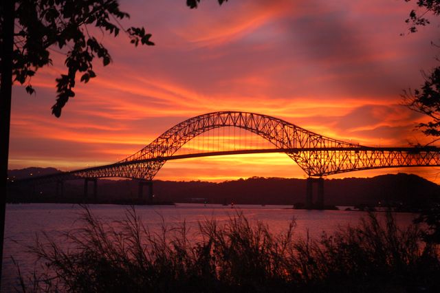
Attachment
1. Sunset over the Panama Canal and the
Bridge of the Americas
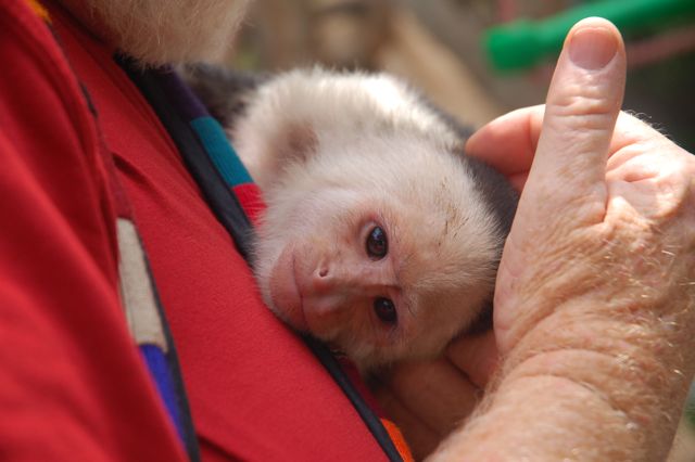
Attachment
2. Rick and Monty the Capuchin monkey,
bonding; Boquete, Panama
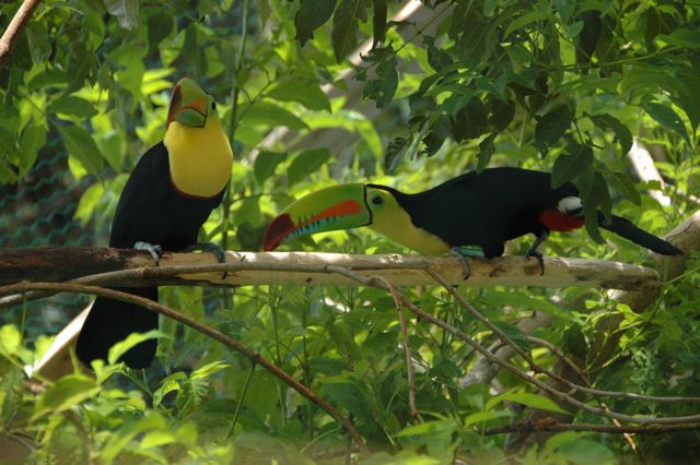
Attachment
3. Toucans, Costa Rica

Attachment
4. A young Panamanian charmer
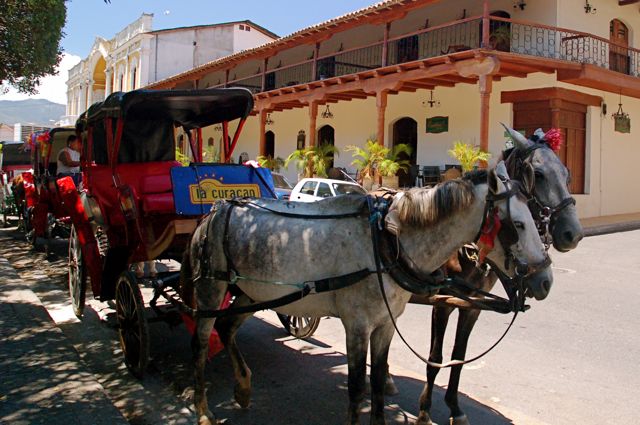
Attachment
5. Anyone for a carriage ride around
colonial Granada, Nicaragua?
Some additional photos
are attached and many more are
available to you at www.flickr.com/photos/kathyrickpics Enjoy.
Captions for attached
photos (not included here yet):
- These guys couldn’t wait
to pose in front of some of the gorgeous murals in downtown Juayua, El Salvador.
- Kathy with Cristobal in
the La Tigra cloud forest, El Rosario, Honduras.
- Evening falls during
Semana Santa, Copan Ruinas, Honduras.
- Frankly, Scarlet, I don’t
give a… If you want to see a Scarlet
Macaw, go to the ruins at Copan, Honduras.
- How many wonderful,
beautiful children are we seeing everyday down here?
This bunch was at recess in Santa Lucia, Honduras.
<Return to Top>